Disaster Risk Management Department
The Department of Disaster Risk Management (DRM) within the Somalia Disaster Management Agency (SoDMA) plays a crucial role in enhancing the country’s resilience to disasters. As Somalia faces various natural and human-induced hazards, effective disaster risk management is vital for safeguarding lives and livelihoods.
The Department of Disaster Risk Management at SoDMA is pivotal in coordinating disaster preparedness, response, and recovery efforts in Somalia. By focusing on risk reduction, early warning systems, climate adaptation, and GIS, the department works to build a resilient society capable of withstanding and recovering from various hazards.
Vision:
To create a disaster-resilient Somalia where communities are prepared for and can effectively respond to disasters, minimizing their impact on lives and livelihoods.
Mission:
To implement comprehensive disaster risk management strategies that encompass prevention, preparedness, response, and recovery, ensuring the safety and well-being of all Somalis.
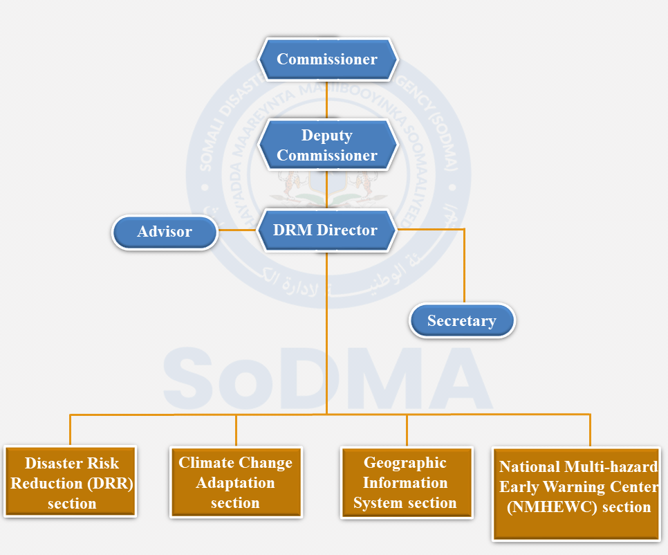
The department have four main sections
- Disaster Risk Reduction (DRR)
- Aims to minimize the impact of disasters through proactive strategies.
- Implements community-based programs that enhance preparedness and resilience.
- Promotes awareness and education regarding risks associated with natural hazards.
- National Multi-hazard Early Warning Center (NMHEWC)
- Provides timely and accurate warnings about impending hazards, such as floods, droughts, and cyclones.
- Utilizes advanced technologies and data collection methods to monitor environmental conditions.
- Works closely with local communities to ensure effective communication of alerts and preparedness actions.
- Climate Change Adaptation
- Focuses on strategies to mitigate the effects of climate change on vulnerable populations.
- Develops programs that promote sustainable practices and resilience-building in agricultural and urban sectors.
- Collaborates with various stakeholders to implement adaptive measures that address climate-related challenges.
- Geographic Information System
- Employs Geographic Information Systems (GIS) to analyze spatial data related to disaster risks.
- Supports decision-making processes by providing maps and data visualizations that highlight hazard-prone areas.
- Enhances planning and response efforts through detailed assessments of vulnerabilities and resources.


")


")